

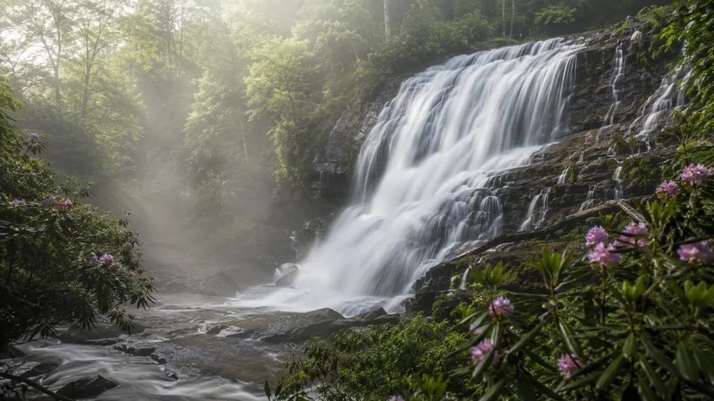
Atlanta sits closer to real waterfalls than most big cities dream of. A spillway fall thirty minutes from downtown, whitewater shoals just outside the Perimeter, a mill fall hidden in Chattahoochee Hills, and, ninety minutes north, the tallest cascading waterfall in the Southeast. This is the honest map: what each one is, how far you walk, and what to expect.
Unlike the rain-fed trickles of flatter regions, North Georgia's falls run on mountain creeks and river shoals, so most of them flow year-round, strongest in winter and spring, gentler in late summer. Every spot below states the real distance and effort, because a waterfall guide that hides the climb ruins someone's afternoon.
One Link for Every Trail You Hike
A short address you control, pointing to your trail photos, maps and plans.
Vickery Creek Falls, Roswell
The closest big-payoff waterfall to the city, about 25 to 30 minutes north of downtown at Old Mill Park in Roswell. The fall pours over the historic spillway dam that once powered Roswell Mill, a broad curtain of water framed by mill ruins and a covered bridge, which makes it as much a history stop as a hike.
The effort scales to your mood: from the trail along the creek's left side it is only about three-tenths of a mile to the falls viewing area, while the full Vickery Creek trail network offers loops of roughly 3.6 to 5 miles through the bluffs above the creek if you want a real walk. Being a dam spillway, the flow holds up better in dry spells than natural falls this close to a city have any right to.
Sweetwater Creek State Park
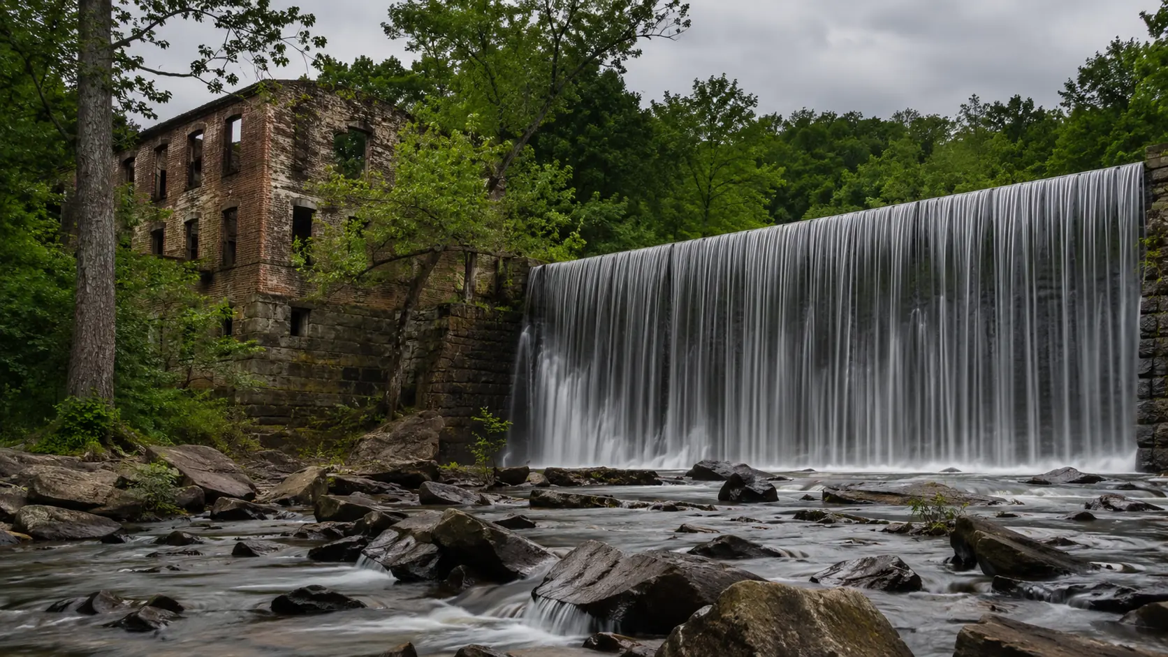
Just outside the I-285 Perimeter to the west, Sweetwater Creek State Park trades one tall fall for a long run of them: the creek drops through a boulder field in a series of whitewater shoals and small cascades, roaring past the brick ruins of the New Manchester Mill. The popular Red Trail follows the bank to the mill and the overlook at the rapids, and stretching the walk into the connecting loops makes a hike of around four miles.
This is the pick when you want moving water plus mileage: the shoals photograph beautifully after rain, the ruins give the walk a destination, and the park's trail system absorbs a whole morning. State parks charge a small parking fee; bring grippy shoes, because the rocks near the water are polished and slick.
Cochran Mill Park, Chattahoochee Hills
South of the city in Chattahoochee Hills, Cochran Mill Park is the quiet one locals keep to themselves: nearly 15 miles of natural-surface trails shared by hikers, mountain bikers and horses, with Bear Creek winding through. The headline walk leads to Henry Mill Falls, a broad fall on the creek, in a round trip of a little under five miles on the Yellow and Red trails.
The distance filters the crowds that pack Roswell on weekends. Expect proper trail conditions, roots, mud after rain, creek sounds the whole way, and bring water; this is the most genuinely woodsy of the in-metro options.
Map Your Own Trail List
Collect the spots you want to hit next in one link you can share with the group.
Day Trip: Amicalola Falls
About ninety minutes north of Atlanta in Dawsonville, Amicalola Falls drops 729 feet, the tallest cascading waterfall in the Southeast, inside its namesake state park. The park stacks the viewing options: an accessible pathway to a lower viewing platform, a staircase route that climbs alongside the cascade for the full-force view, and connecting trails for those who want to earn it, including the approach path to Springer Mountain, the southern end of the Appalachian Trail.
Go early on fall-color weekends; the staircase route is popular for a reason, and the view from the top platform over the cascade and the valley is the single best waterfall panorama within a day of the city.
Day Trip: Anna Ruby Falls
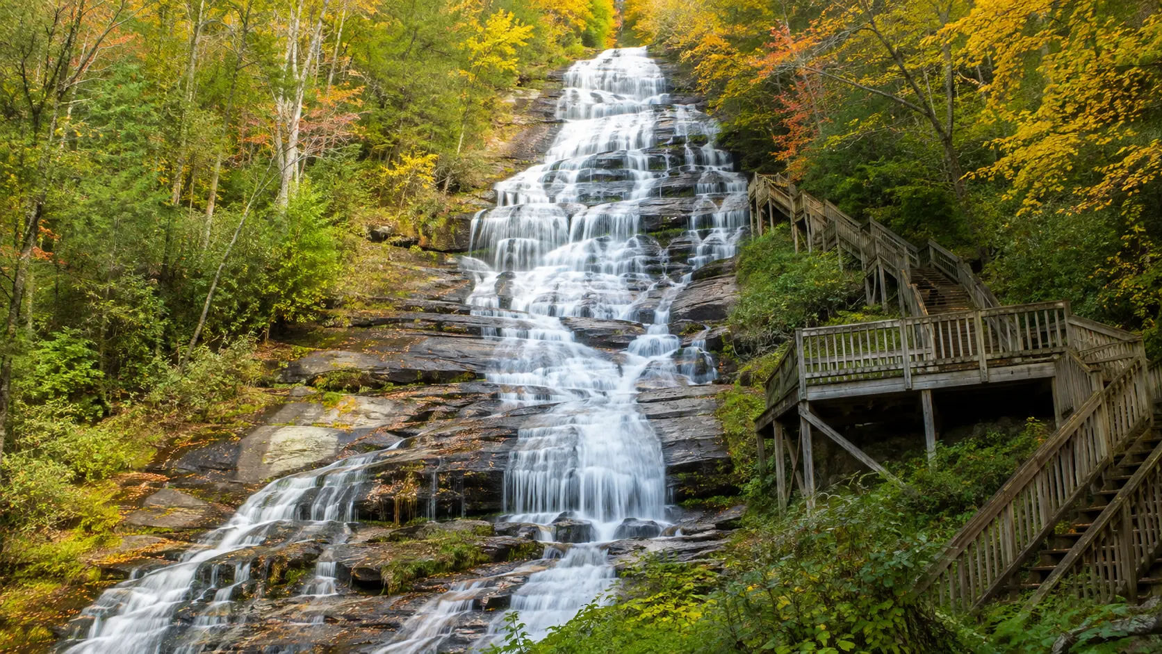
Near Helen, roughly two hours northeast, Anna Ruby Falls is the rare double: twin waterfalls side by side, Curtis Creek dropping about 153 feet and York Creek about 50, joining below to form Smith Creek. A paved trail of about half a mile climbs from the visitor center to the viewing decks, short but steeper than the pavement suggests, and comfortably the best effort-to-spectacle ratio in North Georgia.
It sits in a fee area of the Chattahoochee National Forest and pairs naturally with the Bavarian-village kitsch of Helen for a full day out. Summer weekends get busy; mornings are calmer and the light in the gorge is better.
Practical Tips for Georgia Falls
Winter and spring run strongest. Mountain creeks are fullest after the wet season; late summer softens the flow but rarely kills it, unlike rain-fed falls elsewhere.
Wet rock is the hazard. Georgia's granite and river stones polish slick. Stay on decks and marked viewpoints; the falls injuries that make the news here are almost always from climbing the rocks beside the water.
Fees are small, bring cash or card. State parks charge parking; Anna Ruby sits in a Forest Service fee area. A few dollars, worth every one.
Mornings beat afternoons. Cooler trails, softer light in the gorges, emptier parking at Roswell and Anna Ruby, the two that fill first.
Leave nothing. These parks stay photogenic because visitors pack out what they bring in.
Share the Whole Adventure From One Link
Photos, the map pin, the trail notes: one VisuLink carries it all.
FAQ
What is the closest waterfall to Atlanta?
Vickery Creek Falls at Old Mill Park in Roswell, about 25 to 30 minutes north of downtown, where the creek pours over the historic Roswell Mill spillway dam. The falls viewing area is roughly three-tenths of a mile from the creekside trail.
What is the tallest waterfall near Atlanta?
Amicalola Falls, about ninety minutes north in Dawsonville: 729 feet of cascades, the tallest cascading waterfall in the Southeast, with an accessible lower platform and a staircase route up the falls.
Are there waterfalls inside the Atlanta metro area?
Yes: Vickery Creek Falls in Roswell, the whitewater shoals and cascades at Sweetwater Creek State Park just outside I-285, and Henry Mill Falls at Cochran Mill Park in Chattahoochee Hills.
Is the Anna Ruby Falls trail hard?
It is short, about half a mile of paved path to the viewing decks, but steeper than expected. Most visitors manage it fine with a couple of breathers; strollers make it with effort.
When do North Georgia waterfalls flow best?
Winter and spring, after the wet season fills the mountain creeks. Most run year-round, with gentler flow in late summer; the spillway fall at Roswell holds steady flow better than most in dry spells.