


Atlanta's hiking secret is that the mountains come to you. A granite dome with a 1.3 mile summit trail, a Civil War battlefield laced with 17.3 miles of paths, a moonscape of rock outcrops twenty minutes east, and a trail you can join without a car: the city in the forest earns the nickname on foot.
This guide covers five hiking spots near Atlanta that earn their place for different reasons: the icon, the history walk, the landscape from another planet, the mill-ruins ramble and the urban option. Every number below comes from the references at the end; fees, hours and rules change and were deliberately left to each park's official page, which is worth two minutes before any drive. Chasing falling water instead? The waterfall hikes near Atlanta guide is the companion trip.
One Link for All Your Adventures
A short address you control, pointing to your trail photos, lists and plans wherever they live.
Stone Mountain: The Icon
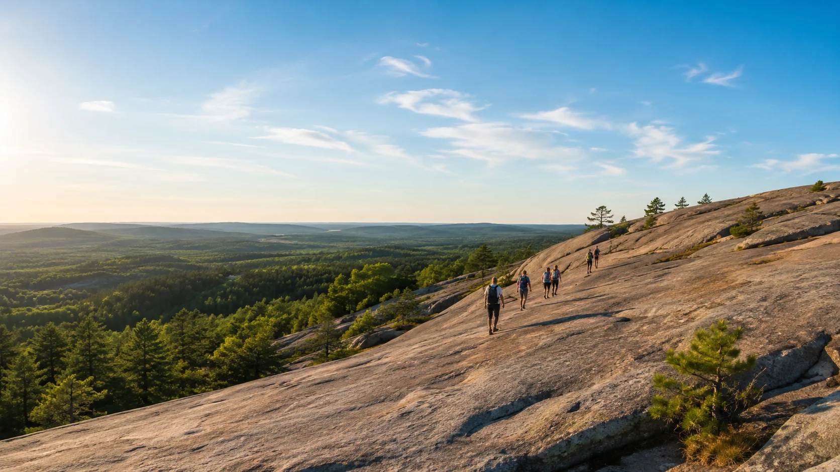
The climb every Atlantan does at least once: the Walk-Up Trail runs 1.3 miles up the bare granite, ascending 786 feet to the 1,686 foot summit. The reward is the region's best natural viewing platform, with the downtown skyline, Kennesaw Mountain and, on the clearest days, the Appalachians on the horizon. Up top, rainwater pools in the rock host their own tiny ecosystem, down to clam shrimp.
Not feeling vertical? The Cherokee Trail, an 8 mile National Recreation Trail, loops the base of the more-than-five-mile-around mountain, and a 3/4 mile Nature Garden loop covers the oak and hickory forest at walking-with-kids pace. One fact worth knowing: the park is owned by the state of Georgia and run by a state authority, with the attractions operated privately, so check the park's own site for current parking and access details before you go.
Kennesaw Mountain: The History Walk
Northwest of the city, Kennesaw Mountain National Battlefield Park spreads 17.3 miles of interpretive hiking trails across 2,923 acres of preserved Civil War ground from the Atlanta Campaign. The paths connect three battlefield areas, from the visitor center grounds to Cheatham Hill, the position soldiers called the Dead Angle.
This is the entry for hikers who want their miles to mean something: every climb crosses ground where history happened, earthworks still ripple through the woods, and the visitor center's film sets the scene before the boots start. Trail options run from short interpretive loops to a full day connecting all three areas; the park's NPS page carries the current trail map and conditions.
Arabia Mountain: The Moonscape
Twenty minutes east near Lithonia waits the most otherworldly landscape in the metro area: the Davidson-Arabia Mountain Nature Preserve, 2,550 acres of granite outcrops and two lakes around a monadnock whose peak stands 955 feet above sea level, rising 172 feet over Arabia Lake. Rare plants bloom in the rock's solution pits, and in places the bare stone stretches wide enough to lose the treeline entirely.
A detail that builds trust with anyone you bring: the outcrop most visitors climb and photograph is actually Bradley Mountain, the southern twin sitting closer to the visitor trails, and it gets misidentified as Arabia Mountain so often the confusion is practically tradition. Either summit delivers the moonscape; now you get to be the one who knows.
Keep Your Trail List in One Place
Link your hike photos, maps and plans from one short address you can share with anyone.
Sweetwater Creek: The Mill Ruins
West of the city in Douglas County, Sweetwater Creek State Park exists because of a ruin: the park was founded to protect what remains of the New Manchester textile mill, burned in the Civil War, and today only the brick walls and the millrace that fed the factory's water wheel still stand above the rushing creek. The riverside walk to the ruins, shaded and steady beside whitewater shoals, is the closest thing metro Atlanta has to hiking through a history novel.
The park also wraps around the George Sparks Reservoir for calmer waterside walking. Trail lengths and current access details live on the park's official page; as a Georgia state park, check it for parking requirements before the drive.
BeltLine Eastside Trail: The No-Car Option
Honesty first: the BeltLine is a paved urban corridor, not a forest hike, and on weekend afternoons its busiest stretch moves like a festival. That is exactly its job. The Eastside Trail's original two mile stretch, opened in October 2012, runs from Piedmont Park to the Krog Street Tunnel through Atlanta's densest collection of repurposed industrial architecture, with Ponce City Market and Krog Street Market as built-in refuel stops.
It is the entry on this list that needs no car, no trailhead and no planning: join anywhere, walk as far as the mood carries, exit into a food hall. For visitors staying in town and locals with an hour, that convenience beats elevation.

Before You Go: Heat and Homework
Heat: Georgia summers are humid and serious, and bare granite doubles as a frying pan by noon. Early morning starts, real water and shade breaks are the plan from May through September, stated here as advice every local already follows.
Homework: fees, hours, parking rules and closures change, and they changed hands at some of these parks in recent years, so this guide quotes none of them. The two minutes it takes to open each park's official page before driving is the difference between a trailhead and a turnaround.
Footing: bare rock at Stone and Arabia Mountains is grippy when dry and treacherous when wet, and the plants living in the rock pools are rare and fragile. Stay on marked routes across the outcrops; the moonscape stays a moonscape because feet stay off its gardens.
Share the Whole Trip, Not Ten Links
One VisuLink holds your photo gallery, your favorite trail pages and everything else worth sharing.
FAQ
What is the best hiking trail near Atlanta?
For the classic summit, Stone Mountain's 1.3 mile Walk-Up Trail. For mileage and history, Kennesaw Mountain's 17.3 miles of battlefield paths. For scenery unlike anywhere else in the region, the granite outcrops at Arabia Mountain.
Are these trails free?
Fees and parking rules vary by park and change, so check each park's official page before visiting. This guide deliberately quotes no fee amounts because they go stale.
Which hike is best for kids?
Stone Mountain's 3/4 mile Nature Garden loop for small kids, the BeltLine for strollers and snacks, and the Sweetwater ruins walk for kids old enough to be impressed by a burned mill.
Is the Atlanta BeltLine really a hike?
No, and it does not pretend to be: it is a paved urban trail. It earns its place as the walk that needs no car, joining Piedmont Park to the Krog Street Tunnel through the city's best repurposed architecture.
Why do people say the Arabia Mountain summit is mislabeled?
The outcrop closest to the visitor trails is Bradley Mountain, Arabia's southern twin, and visitors regularly summit it believing it is Arabia Mountain. Both peaks deliver the same granite moonscape.